Why it matters
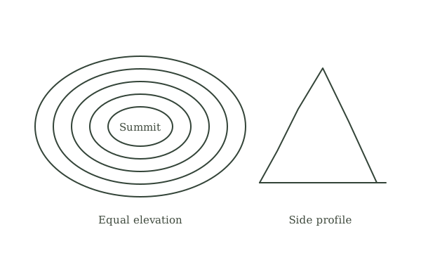
A simple plan view exposes direction, clearance and access problems before materials are cut or a route is chosen. A mental picture is a draft; measurements and site checks correct it.
What you’ll need
Tools
- Paper and pencil
- Ruler or tape
- Simple objects for a model
Materials
- Small room, work area or familiar route
Before you begin
Safety & limits
- Do not use an unverified sketch as a load-rated, electrical or structural plan. Check real dimensions and professional requirements before irreversible work.
Work carefully, in order
The method
- 01
Choose a bounded space
Pick a table, small room or familiar route. Define a starting viewpoint and the key objects that must fit or be passed.
- 02
Draw a top view
Represent fixed features as simple shapes. Mark north or a room wall so left and right do not silently reverse when the paper turns.
- 03
Estimate and measure
Place approximate dimensions first, then use a ruler or tape to measure the most important spans and clearances. Mark units and uncertain areas.
- 04
Rotate or rearrange
Imagine moving an object, then rotate a small paper model or cutout to check the guess. Consider door swing, walking route and tool access.
- 05
Walk the sketch
Compare the plan with the real location, correct mismatches and record a revised version for the actual decision. Treat the corrected drawing as the current version and date it so an earlier sketch is not mistaken for the final layout.
Mistakes to avoid
- Confusing plan view with eye-level view
- Reversing directions after turning the page
- Forgetting movement clearance
If it isn’t working
The model fits but the real object does not
Recheck scale, thickness and clearance with physical measurements.
Directions keep reversing
Add an orientation arrow and fixed landmark to every sketch.
Then & now
Historical context
Builders and navigators used sketches and models to test ideas. Modern maps and drawing apps serve the same role when anchored to observed dimensions.
The modern equivalent
A drawing or mapping app makes revisions easier but does not verify a guessed dimension.
Sources & review
Editorial draft — specialist review pending. Written 2026-09-24. Sources support the stated scope; this page has not been professionally certified.
- National Geographic Education — Mental Mapping and Perception ↗
Compare mental sketches with the observed physical layout. Checked 2026-09-24.
- National Geographic Education — Mapping the Classroom ↗
Translate familiar object locations to a simple plan view. Checked 2026-09-24.