Why it matters
Map scale connects a page measurement to ground distance, but a straight map segment omits turns, terrain and elevation. Keeping units in every calculation prevents a small planning error from becoming a large field error.
What you’ll need
Tools
- Current map or chart
- Notebook and pencil
- Compass for verification
Materials
- Familiar safe observation area
Before you begin
Safety & limits
- Never use a rescaled printout with a ratio that no longer matches its scale bar.
- Route length and travel time also depend on terrain, ability and conditions.
Work carefully, in order
The method
- 01
Prepare
Locate the scale bar and date on a current map; check whether it is printed at the intended size. Treat the result as a preliminary observation and compare it with the linked official guidance before using it in a trip plan.
- 02
Identify
Choose two known points and trace the likely path with a string or paper edge. Treat the result as a preliminary observation and compare it with the linked official guidance before using it in a trip plan.
- 03
Measure
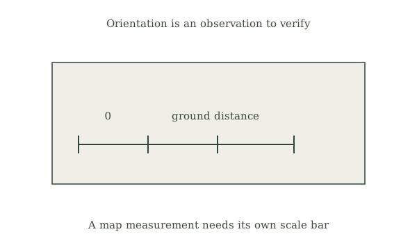
Measure that path against the printed scale bar, recording both map and ground units. Treat the result as a preliminary observation and compare it with the linked official guidance before using it in a trip plan.
- 04
Cross-check
Compare the result with the direct straight-line measurement and note bends or elevation. Treat the result as a preliminary observation and compare it with the linked official guidance before using it in a trip plan.
- 05
Record
Check the converted distance against a digital map or published route description before a real trip. Treat the result as a preliminary observation and compare it with the linked official guidance before using it in a trip plan.
Mistakes to avoid
- Using an old or rescaled map without checking its legend
- Treating an approximate observation as an exact position
- Ignoring weather, terrain or a safe turnaround time
If it isn’t working
Two direction clues disagree
Stop in a safe known area, check the map orientation and measurement, and use a reliable compass or qualified local advice before proceeding.
Conditions hide the expected landmark or sky
Do not guess: use an established route and another verified navigation method, or turn back to a known point.
Then & now
Historical context
Printed topographic maps paired scale bars and contours for trip planning; digital maps still have scales that change when zoomed.
The modern equivalent
Current official mapping, trip alerts and a maintained navigation device can complement field observations; keep an independent map and a plan for loss of power or signal.
Sources & review
Editorial draft — specialist review pending. Written 2026-09-24. Sources support the stated scope; this page has not been professionally certified.
- U.S. Geological Survey — Map reading ↗
Primary educational or planning source for the method and its limitations. Checked 2026-09-24.
- U.S. Geological Survey — Map reading ↗
Primary educational or planning source for the method and its limitations. Checked 2026-09-24.